


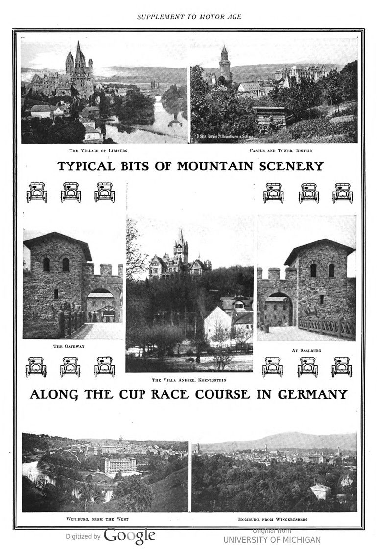
In this issue of „Motor Age“ the 1904 Gordon Bennet Cup racecourse in Germany is described. Names like Saalburg, Weilburg, Limburg, and Homburg indicate that this part of Germany has a castle-rich history. Idstein, Koenigstein, as well as Esch and Ober-Ursel are well-known names that nowadays still bring back memories of that 1904 Cup race.

Text and photos with courtesy of hathitrust hathitrust.org, compiled by motorracingistory.com.
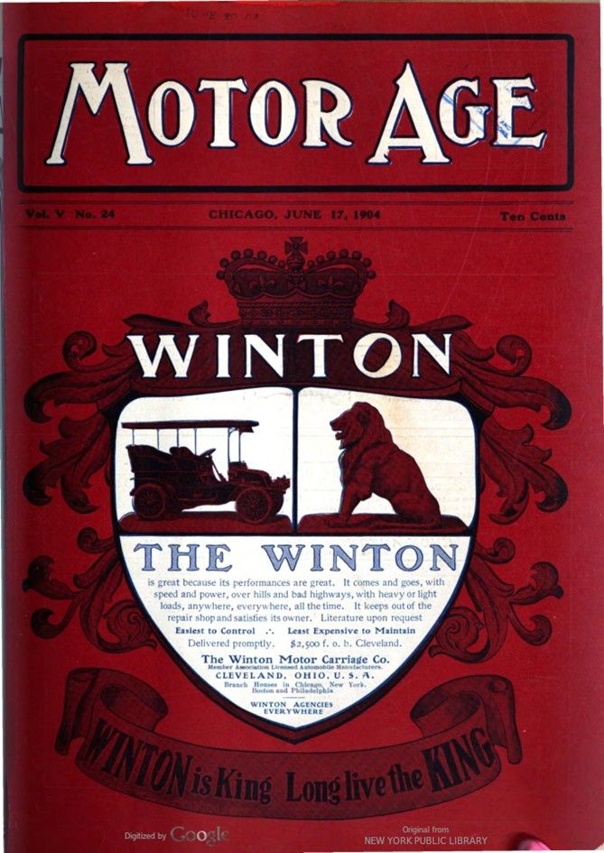
MOTOR AGE VOL. V. NO. 24. JUNE 17, 1904.
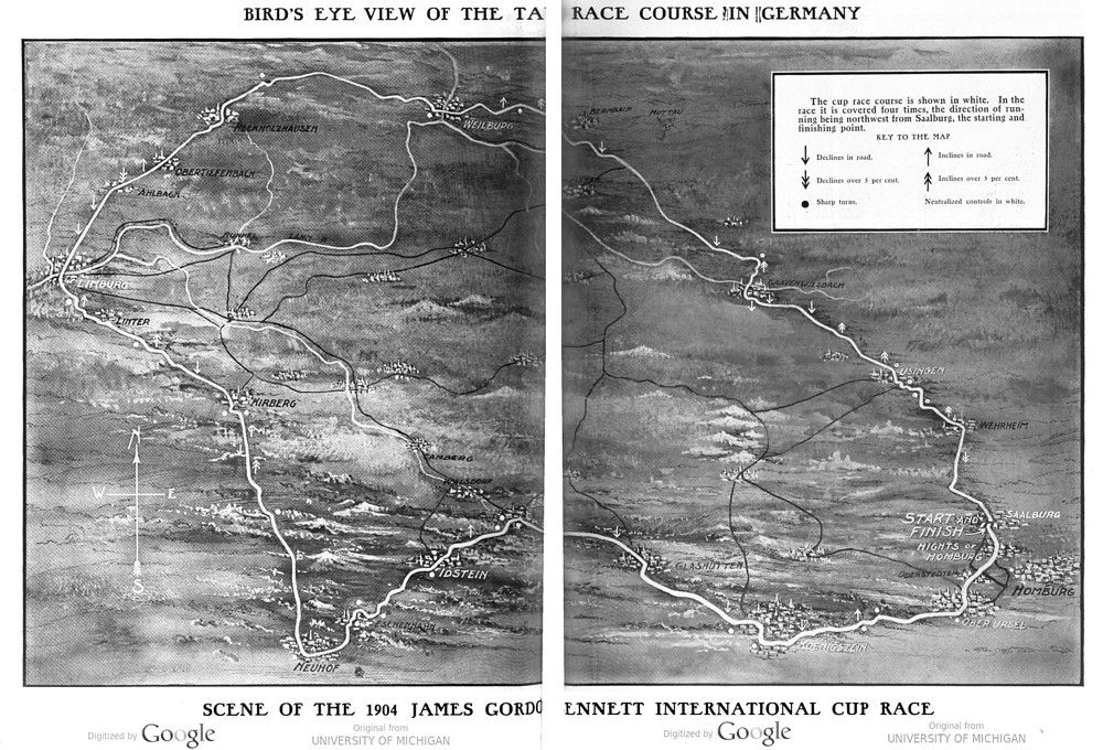
GERMAN CUP RACE COURSE
The international cup race is run over a circular course selected by the German Automobile Club and whose use was authorized by the German government. It is in the wooded, mountainous portion of central western Germany, in the province of Hessen-Nassau and is in the immediate vicinity of numerous well known watering places. In the midst of picturesque hills, the scenery is characterized by castle-crowned peaks and wooded slopes.
The entire circuit is 137.6 kilometers – 85.3 miles – in length, and as it will be covered four times, the total gross distance is 550.4 kilometers, or 341.2 miles. From this the neutralized stretches through important towns must be deducted to determine the net racing distance. These towns, enumerating consecutively from Saalburg, the start and finish, are Usingen, Weilburg, Limburg, Idstein, Esch, Koenigstein, Ober-Ursel and Homburg Hights.
There are certain points where the quality of wagon and tactical knowledge of the driver will be of the utmost importance in covering the course – critical points where the driver’s judgement will either bring him close to the danger point or will help him to keep the lead over his rivals. At such points one will find the most interesting contests, but more important in the race are the long stretches of level road, where may be fought the real speed battles for supremacy.
The road as a whole is good, a few places excepted, and these have been improved for the occasion. The width of the course varies from 6.5 to 11 meters – 21 to 36 feet – and at the narrower places the footpaths are utilized to give the participants a chance to pass one another.
In parts the race-course, where not surrounded by forests, traverses scenically beautiful country. At certain points the landscape becomes a higher picturesque panorama. The towns of Weilburg, Limburg, Idstein and Koenigstein especially gladden the eye of the visitor.
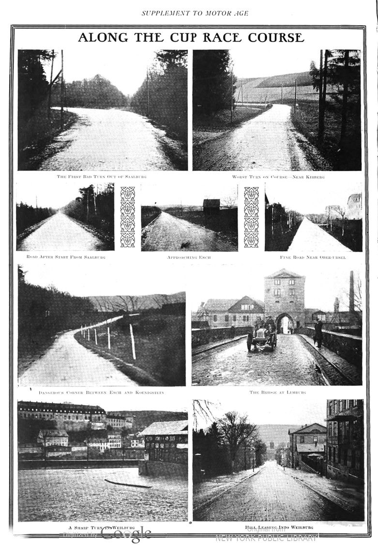
The road leading from Homburg is the old Napoleonic route, 10 meters in width, of which 7 meters is macadamized. It extends upwards through Dornholzhausen to the heights of the Saalburg. Shortly before this point is reached there is a curve to the right, which has been straightened out by removing the trees and shrubbery and thereby widening the road to form a suitable starting and finishing stretch. Here on the right and left have been erected the grandstands which will be connected by a bridge so that the racers will pass under this archway and spectators will be kept off the road.
About 100 meters back of the grandstand is the starting point. From here the road slightly elevates for about 200 meters; then goes for a long stretch downgrade.
Just beyond the start is a knoll which quickly hides the racers from view. The sudden downgrade offers the starters a chance to get under way quickly.
The road then turns to the left in a slight curve with a drop of 5 per cent and then rises about 1.5 per cent. This stretch offers a beautiful fast run. The road at this point is magnificent and should a car overhaul its predecessor there is width enough for an interesting contest for preferred position.
The first town is Wehrheim. A viaduct has been built here to serve as a reviewing stand for the school children, school being closed for the day in honor of the race. In this town is a very disagreeable turn, and the driver’s ability to handle his car will be well tested. Just beyond the town is a slight upward grade.
Just as kilometer post 24.9 is reached the forest begins, and after entering it is a rather sharp curve, at a right angle to the left.
A few miles further on is an S-curve, whose turns are both at right angles. A delay is possible at this point, as the drivers will be compelled to use great care. A little farther on is another sharp S-curve downgrade. It is assumed that curves with rising grades or on the level are easily mastered, but the curves with a downgrade demand the driver’s complete attention.
From here to Usingen there are a number of wide curves and an S-curve.
Beyond Usingen the road is fairly level and straight, although shortly after leaving the town there is an unimportant curve to the left and a very slight down grade; then a straight level run for a mile. Next is a wide curve to the right with up grade, and just after that an S-curve, left to right, with very steep embankment on the right-hand side. At Kilometer post 30 is the top of the incline and the road runs downward on a curve to the right, becoming steeper turning to the left. It then rises again and reaches the top of another incline, then goes downward sharply. To the left is a forest. Then there is another rise, an S-curve, left to right, and the road becomes level for a distance. The road is next rolling until a curve at 33.6 kilometers is reached where it descends, at kilometer 34.9 is encountered a bad S-curve which leads with a heavy down grade in two sharp turns, right to left, to Gravenwisbach. This is considered a critical point because, after a lively run, the road descends suddenly and great care is required. Immediately beyond this curve is a second, double curve, with steep down grade. In case of rain, brakes are not sufficient to keep the cars from sliding on these two S-curves and the speed must be lessened before reaching this place; consequently the entire distance from Usingen to Graevenwisbach must be traversed at a slow pace.
The entrance to Graevenwisbach must be equally slow on account of a steep down grade and a sharp curve to the left into town. This city is highly interesting from an automobile standpoint.
Steep streets, crooked roads, chickens, geese, pigs and their descendants are in abundance, though, of course, an effort has been made to remove all this live stock on the race day. It was intended to neutralize the streets here but the plan was abandoned, and if the streets are slippery drivers must be very careful not to come to grief by running into buildings.
Just beyond Graevenwisbach is a beautiful straight run. The scenery is pleasing. To the left is an imposing forest, to the right a broad, picturesque valley. After a curve to the right at kilometer stone 53, there is another straight run to kilometer stone 54 where there is an L- curve to the right.
Five kilometers farther on the road turns into another L-curve to the right and here, at kilometer stone 54.7 is obtained a magnificent view of the mountains. At kilometer stone 56 the road descends steeply toward Weilburg and grows still steeper before entering town.
Through streets, partly down grade, this beau- tiful little river town is passed over a bridge crossing the river Lahn, and after a short, slowly-rising run the foot of the mountain is reached.
The race course continues through a beautiful, shaded roadway, which quickly takes a steep upward course, because the land here rises out of the narrow Lahn valley to the plateau between Weilburg and Limburg. This is on the right shore of the Lahn which must be recrossed at Limburg.
The course still continues on the old Napoleonic war road which is of comfortable width just beyond Weilburg and after that broadens out still more, to the width of 11.5 meters.
At kilometer stone 59 is a slight curve to the right, and then is reached the heights, whence is had a most wonderful view of Weilburg and the Lahn valley. A curve to the left leads to a fine straight piece of road, continuing through the forest to kilometer stone 60.6. After another curve to the right is another straight run to 61.2 kilometers, where the road assumes the width of 11.5 millimeters; then we turn in a slight curve to the right and then into a straight, slightly rolling road to kilometer stone 62.5. Here the old Napoleonic route is left, and the course turns with a curve to the left into the road to Limburg, which leads at once to the town of Allendorf. The entrance into town is down grade.
From Allendorf is a slight up-grade to a knoll, then comes an S curve, which on account of its down-grade demands great foresight. Continuing, the road to Heckholzhausen is unimportant-a curve to the left, a slight rise, a down curve to the right and then a straight run.
Heckholzhausen is entered over a narrow bridge, and 200 meters farther on, in town, is a narrow, right-angle curve to the left. This point can be passed at a moderate speed only, as the street at the centre of the curve is not very broad and the road beyond cannot be seen. There is not much to be said about the short distance to Obertiefenbach. Immediately after leaving Heckholzhausen the road ascends and at once strikes an L-curve, to the right. A little further there is a second one, to the right, and still another one to the left. Then there is a curve to the right and a straight run. The road is through a rolling, well settled district. Next is a curve to the left and then a fine straight run for a kilometer when there is a slight bend in the road which from here runs in a single line to Obertiefenbach.
This town is of great interest to the racers because the main street is winding, narrow and declines, demanding care and ability in hand- ling the cars. The run from Obertiefenbach to Limburg is easily described. After a small curve beyond Obertiefenbach comes a good, even run for 3 kilometers, when the road dips downward, and then runs straight for 2 kilometers. Here is a curve to the left, then another straight run to the entrance of Lim. burg. This stretch of road is good battle ground and time lost on the Weilburg run may be made up. The contestants can see their rivals, and the road is broad enough for several cars to run abreast.
At the entrance to Limburg the road takes a downward course into the Lahn valley. Limburg, a town of about 9,300 inhabitants, is about in the center of the race course on the main road from Koeln to Frankfurt, as well as on the beautiful and interesting road from Coblenz to Montabour and to Limburg.
Just beyond Limburg, at the brewery, the road is slightly upgrade and, though one flat curve follows another, the road is always visible. About a kilometer beyond Limburg, for a distance of 3 kilometers is a straight run to Kilometerstein, where there is a curve to the right and then a second one up grade and to the left. Then the road is almost straight road to Kirberg. Just before entering the town there is a turn to the right and then a piece of difficult road. The entrance into Kirburg leads over a narrow curve, down grade, to the right, and while it may not be a critical point, prudence is necessary in negotiating it. Immediately afterward, at the Hotel Burg, the street turns at a right angle to the left, and about 100 meters farther on is a similar narrow, winding and up-grade street.
No sooner has this narrow pass, which continues down grade a short distance, been traversed than there is a sharp turn to the right, and then have been mastered the difficulties of Kirberg. Full or even half speed is out of the question in passing through this town.
Leaving Kirberg is a straight up and down grade road to a forest, continuing with scarcely an interruption for 13 kilometers. Huehner-Kirche is passed on a straight run, but an ascending road leading to Neuhof. The street through Neuhof is downgrade and the exit from the town is around a sharp corner leading into a road considerably narrower but in good condition. This narrow roadway has been improved by extending it beyond the footpaths.
From Neuhof almost to Eschenhahn the road offers a good run, but at the great Eschenhahn curve a critical point is struck, because of its serpentine shape. It begins with a turn to the right for three-quarters of a circle, with considerable down-grade, and changes into a narrow curve to the left and continues through a treacherous path. This curve and the immediately following narrow road are dangerous. After this curve the road continues down-grade through the streets of the town, which offers nothing worthy of note. The road then begins to rise, but drops downward again towards Idstein. The entrance to Idstein is one demanding more than ordinary care, running in a serpentine curve.
After leaving Idstein a serpentine course goes through the forest up grade, and then on a straight, slightly rolling road to the point where begins the descent to Esch. This road is of moderate width, but is otherwise good for fast travel. The run through Esch is by a number of uncomfortably sharp turns. There are, leaving out the less important turns, three, all at right angles, at which the road ahead is hidden by projecting buildings. The street through this town is in fair condition, but as such streets are, as a rule, damp and slippery the driver must be cautious in making the turns. From Esch the course is over a hill to Koenig- stein. Then is struck a narrow curve and an S curve, up grade; then a straight run to Glasshuetten, the street of which turns to the left twice down grade. The latter curve is considered dangerous by local automobilists. Now there is a straight scorch to Koenigstein, while the road to Oberursel offers nothing exciting, there being a few upward, downward and flat curves. This road is in very good condition and offers a splendid opportunity to make headway. The ride through Oberursel is not a comfortable one and is followed by a piece of road with unimportant turns, leading towards Homburg.
The final run back to the starting point is over a new roadway, expressly laid out for the race. This road leads in an even up grade, with slight serpentine curve to a point a little beyond Dornholzhausen, which is to the left as passed. Then is a turn into the Homburg-Saalburg road, whence is a straight run to Saalburg, with a slight turn just before the starting point is reached and the circuit completed.
H. Austin, of the Automobile Club of Great Britain and Ireland, who went over the entire Taunus road during the first few days of this month, made some interesting remarks at his return in London. „It does not seem to me that the course is a very fast one, and, compared with the one upon which the English trials were run, it is strikingly similar. The fastest part will be a straight line between Weilburg and Limburg. There are many hills, bad corners and few straight stretches. It is a course upon which great care and watchfulness will have to be exercised and the speediest car will not necessarily be the winner. There are not so many controls as in my opinion there ought to be to insure perfect safety, although the country is not thickly populated.“
Photos.
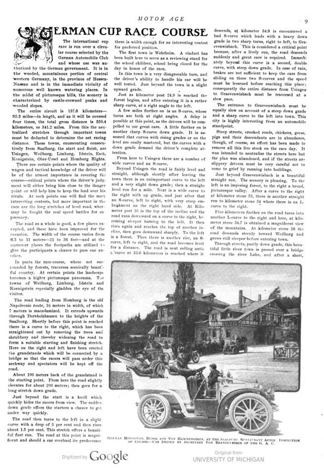
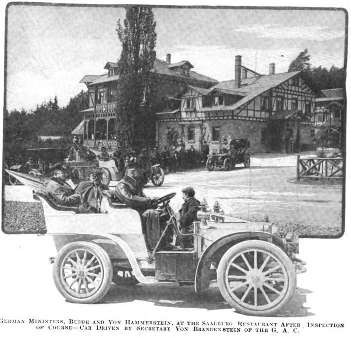
GERMAN MINISTERS, BUDDE AND VON HAMMERSTEIN, AT THE SAALBURG RESTAURANT AFTER INSPECTION OF COURSE – CAR DRIVEN BY SECRETARY VON BRANDEN STEIN OF THE G. A. C.
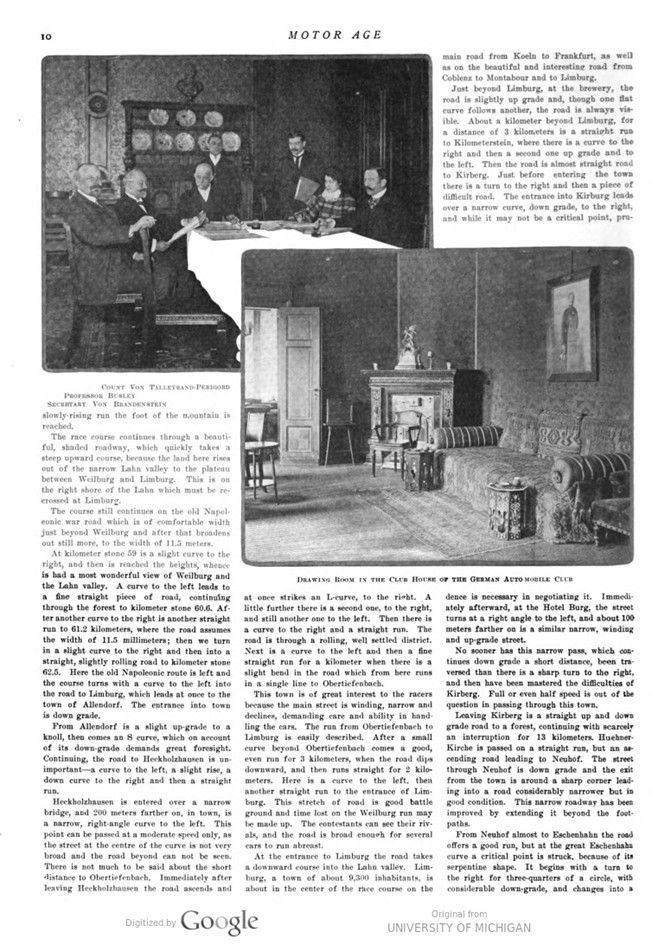
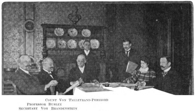
COUNT VON TALLEYRAND-PERIGORD – PROFESSOR BUSLEY – SECRETARY VON BRANDENSTEIN
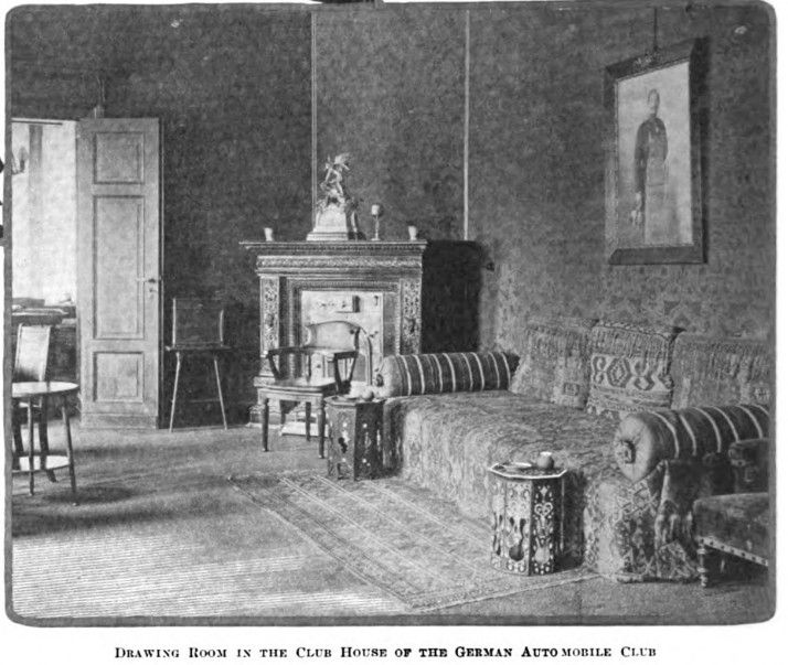
DRAWING ROOM IN THE CLUB HOUSE OF THE GERMAN AUTO MOBILE CLUB